There are 4 major global satellite positioning systems: GPS, Galileo, GLONASS, and BeiDou. Each of them has very specific characteristics. These technologies are used daily in many fields such as navigation, agriculture, and outdoor activities. They allow us to locate ourselves almost anywhere in the world with incredible accuracy, making modern life easier and improving user safety. However, their performance varies depending on the geographical area, environmental obstacles that may interfere with satellite signal reception, as well as atmospheric conditions (such as solar storms or the ionosphere) affecting signal accuracy. To better understand their specific features and use them with full knowledge, here is a detailed comparison of their characteristics.

GPS
History
The Global Positioning System was originally called Navstar GPS. This global satellite positioning system was developed in the late 1960s by the United States Department of Defense at the request of President R. Nixon. It was initially used for military operations. This made it possible to establish a global positioning system anywhere on Earth, 24 hours a day and in all weather conditions. It was an exceptional breakthrough in the military field, and later for civilian applications as well.
In 1978, the first satellite was launched. This GPS system was made available free of charge to civilians in 1983 by President R. Reagan following an aviation accident that claimed the lives of 269 passengers. For optimal efficiency, additional satellites were launched in 1989. However, it was not until 1995 that the system became fully operational with its 24 satellites.
Technology
This system can be used by anyone on land, at sea, or in the air. For its operation, it consists of three groups of components: satellites placed in orbit around the planet, ground stations used for data management, and the users’ GPS receivers.
To calculate the distance between the receiver and the satellite, the latter uses electromagnetic waves. They travel at the speed of light, making it possible to calculate the distance between the satellite and the receiver: you simply compare the transmission time with the reception time of the signal and multiply it by the speed of light.
Accuracy
In 1995, the GPS system provided worldwide accuracy of around 328 ft [100 meters] for civilian users. Thanks to President B. Clinton, this geolocation system became more widely accessible and improved its accuracy to approximately 33 ft [10 meters].
The accuracy of geolocation depends on the position of the satellites. However, if at least 4 satellites are available, the result is generally quite reliable, ranging between 16 and 33 ft [5 and 10 meters].
Performance and Accessibility
Since 2000, this system has been highly effective in terms of location tracking and extremely accurate. It is used in aviation, automotive and maritime navigation, smartphones, and animal geolocation...
Limitations
This geolocation system cannot easily be used in every situation. Inside buildings, its use is almost impossible. WiFi systems are more effective.
In addition, certain obstacles can reduce the effectiveness of these GPS systems: in mountainous areas or highly urbanized environments.
This GPS system was designed and remains under the control of the U.S. military. As a result, the signal could theoretically be degraded through reduced accuracy if the United States government decided to do so. Until May 2000, the accuracy of this system in standalone mode was approximately 328 ft [100 meters] due to intentional signal degradation. The accuracy of civilian signals had been intentionally altered by a feature called Selective Availability (SA) for national security reasons. President Bill Clinton removed this feature, and GPS systems became much more accurate: between 16 and 49 ft [5 and 15 meters].

Galileo
History
This satellite positioning system was developed by the European Union and is expected to become fully operational after the launch of the final satellites at the end of 2024.
The project was initially launched in 2003 by the European Union and the European Space Agency. The objective was to end Europe’s dependence on the United States and the GPS system.
Technology
The Galileo geolocation system uses 30 satellites, including 6 backup satellites. Twenty-six had been placed into orbit by the end of July 2018. The launch of 10 additional satellites was planned between 2022 and 2025.
Galileo offers 4 services:
- Open Service corresponds to the standard GPS usage commonly used by individuals. If it uses 2 frequency bands, the receiver can obtain a signal with an accuracy of 13 ft [4 meters] horizontally and 26 ft [8 meters] vertically. If only one of the two frequencies is used, the accuracy will be lower: 16 ft [5 meters] horizontally and approximately 115 ft [35 meters] vertically.
- High Accuracy Service (HAS: High Accuracy Service) uses the 2 bands from the open service along with an additional frequency band. The accuracy is much more precise: approximately 8 inches [20 cm] horizontally and 16 inches [40 cm] vertically. This can be supplemented by signals from ground stations and achieve accuracy levels below 4 inches [10 cm].
- Public Regulated Service (PRS: Public Regulated Service) is used by public service users where accuracy, signal quality, or transmission reliability must be extremely high (emergency services, hazardous material transport, etc.). This system must remain available at all times; therefore, it uses 2 signals along with several systems designed to prevent signal jamming. It is also encrypted and available only on specific receivers.
- Search and Rescue Service (SAR for Search and Rescue Service) ensures the localization of all emergency beacons in distress situations. The satellites capture signals and send back accurate information about the location.
Performance
This geolocation system can be used in the civilian sector (merchant shipping, aviation, ground transportation, etc.) as well as for military applications (troop positioning, missile guidance, aircraft navigation, etc.). It is also used in search and rescue operations.
Accessibility
100 million smartphones were compatible in February 2018, then one billion by September 2019, throughout the entire European system. Galileo complements the GPS, GLONASS, and BeiDou systems.
Limitations
Like all geolocation systems, Galileo is less effective in urban environments (tall buildings, etc.), tunnels, or because of natural obstacles such as mountains and dense forests.
Some chip and device manufacturers outside of Europe still prioritize the American GPS system.

GLONASS
History
The GLONASS satellite positioning system (Globalnaya Navigazionnaya Sputnikovaya Sistema) is a Soviet system. It is managed by the space forces of the Russian Federation. Its development began in the 1980s and it became fully operational in 2010.
Initially, it was intended for military applications, mainly to guide missiles and enable the navigation of Soviet forces.
Technology
The GLONASS system uses 24 satellites. Their inclination differs from that of other geolocation systems, providing better coverage of the polar regions (which make up a significant part of Russia’s territory). They are positioned at an altitude of approximately 11,870 miles [19,100 kilometers].
Accuracy and Performance
This geolocation system offers accuracy of 16 to 26 ft [5 to 8 meters] using seven to eight satellites. By receiving signals from six to eleven satellites, this network provides accuracy ranging from 6.5 to 29.5 ft [2 to 9 meters]. The operational efficiency of GLONASS improved to 18 ft [5.5 meters] in 2010, and to 9.2 ft [2.8 meters] in 2011. When this geolocation system is used alongside GPS, it delivers even better performance.
The GLONASS system is used by surveyors, cartographers, automotive navigation, emergency services, smartphones, and more. It is also an essential tool for the Russian military.
Accessibility
Two types of services are offered:
- The first system has been available to everyone through smartphones since 2007: motorists, etc.
- The second is more precise and requires decryption keys. This system is reserved for the military.
Limitations
The GLONASS geolocation system is generally less accurate worldwide than GPS, but more effective in the polar regions thanks to the inclination of its satellites. However, improvements are expected with the launch of next-generation satellites known as GLONASS-K and GLONASS-M.
Interesting Fact
This Russian geolocation system integrated an emergency call system called ERA-GLONASS. This system is similar to the European eCall system and makes it possible to send alerts to emergency services in the event of a car accident, along with precise information about the location of the incident.

BeiDou
History
BeiDou, also known as BDS (BeiDou Satellite: short for BeiDou Navigation Satellite System), is the global satellite positioning system developed by China. The country wanted its own system for reasons of national security and technological sovereignty.
The implementation of BeiDou-1 began in 2000. The system was declared operational in 2003. It was a regional system that only allowed users to determine their position within China and neighboring regions. Its accuracy was approximately 328 ft [100 meters]. BeiDou-2 (2012) was an experimental project that provided global coverage with an architecture completely different from other geolocation systems: 5 satellites in geostationary orbit, 3 inclined at 55°, and 27 in medium Earth orbit. BeiDou-3 began with the launch of its first satellite in 2015 and concluded with the launch of the final satellite in 2023. This system includes 5 satellites in geostationary orbit, 3 inclined at 55°, and 27 in medium Earth orbit.
Technology
The first version, BeiDou-1, offered only regional coverage (China and neighboring countries) in 2003 using signals from 3 geostationary satellites. BeiDou-3, on the other hand, provides fully operational global coverage as of 2020.
Accuracy
Two types of services are available:
- A first public service offering accuracy of less than 33 ft [10 meters] has been available since 2013. BeiDou-3, launched in 2022, provides accuracy below 23 ft [7 meters] horizontally and below 33 ft [10 meters] vertically. Currently, for civilian users, geolocation accuracy is approximately 8 to 16 ft [2.5 to 5 meters], although it may vary depending on the region of the globe.
- Another service is reserved for the military, and its level of accuracy has not been disclosed.
Performance
In addition to being as efficient as other geolocation systems, BeiDou offers a short messaging service (up to 1,200 characters). This is a unique feature. It allows users, especially in remote areas or during natural disasters, to communicate through the satellite network even without terrestrial mobile coverage.
Accessibility
If the BeiDou geolocation system is used by civilians, it provides a less precise position than the application available for the military. It can be integrated into smartphones for motorists as a navigation system. In China, it is used for managing road, maritime, and air traffic, as well as in agriculture, fishing, and logistics.
Limitations
Like other geolocation systems, its effectiveness is reduced in certain situations: in mountainous areas or highly urbanized environments where obstacles are difficult to overcome.
Interesting Fact
"BeiDou" comes from Mandarin and refers to the "dipper" or "ladle." It is a reference to the Big Dipper constellation. This group of stars is called Běidǒu in Mandarin.

Summary of the Comparison between Major GPS Systems and Their Applications
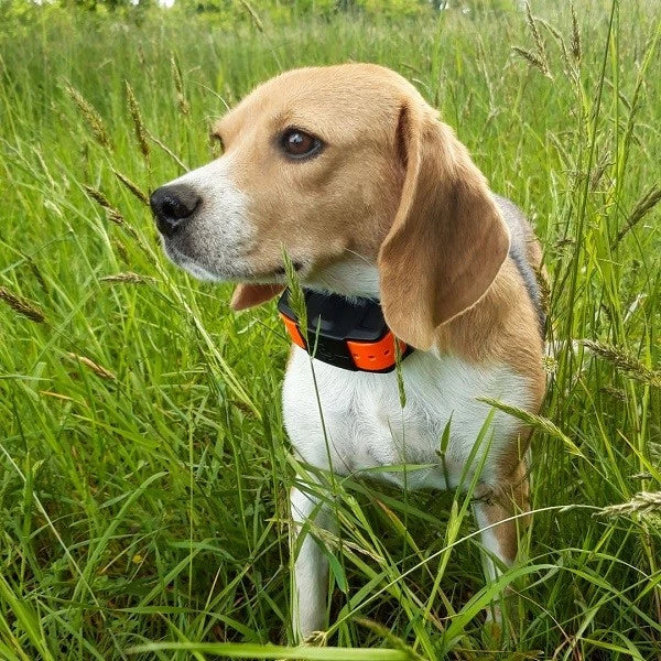
These technological achievements first enabled exceptional advances in the military field. Once they became available to civilians, these systems quickly became widespread. Their accuracy and performance have improved over the years, allowing them to be used today in a wide range of fields, from everyday geolocation to more specialized applications such as maritime navigation, agricultural management, and scientific research. They also make it possible to track your dog and recover it in any situation! This can be especially useful during hunting seasons or for dogs that are prone to running away. In the future, we can expect even more accurate and globally accessible systems.